Thursday, July 7, 2011

What are the chances...?

...that I would run into the only other Fund for Teachers Fellow who was in Iceland at the same time that I was?  Well 100%!  I was in my final hours in Reykjavik walking the streets before I needed to get back to my hotel room to pack up to leave for home the next morning.  You could imagine my surprise when someone stops me in the streets of downtown Reykjavik and says - "you're the Fund for Teachers grant winner from Vermont!"  Well that was exactly what happened when Kristie Long spotted my Fund for Teachers hat and remembered the Facebook post by Fund for Teachers that a Vermont teacher was heading to Iceland a few days before she left.   
Pictured are Chris Shaffer, science teacher from Newport, Vermont, and Kristie Long, mathematics teacher from Houston, Texas.  This picture was taken about 3 minutes after running into each other on the streets in downtown Reykjavik. 
It is amazing how quickly one bonds with another person when they are traveling far away from home and you find someone that is sharing a similar experience as you.  We are both Fund for Teachers grant winners traveling solo to Iceland for over a week.  When we met, it was as if we had known each other for much longer and we spent the next couple of hours walking the streets of Reykjavik talking about our experiences in Iceland.  Kristie is from the Johnston Middle School in Houston, Texas and her grant was to study the geology, history, and culture of Iceland and Greenland and relate these areas to mathematics and the other core subject areas. 

Kristie asked me if I had tried the Greenland shark yet?  I told her no I didn't and that I was willing to try it, but I hadn't gone out of my way to seek some out.  Greenland shark is an Icelandic delicacy that needs to be buried in the sand for 6-12 weeks in order for the toxins that are present when the shark first caught to be pressed out of the body.  Basically if you ate this shark (known as Hákarl) as a "catch of the day", you would get sick (if not die), so instead you have to wait until is has rotted a bit allowing the toxins to exit the shark.  From all of the explanations of this dish, I have yet to find one that has a flattering description.  Ironically, we were in search of this at the local markets while we caught up on each other's trip details.  In a bitter-sweet moment, we were unable to locate any at the two stores that were supposed to have it.

Kristie had a back-up plan to get an iconic Icelandic hotdog (pylsur) from the stand that is mentioned in the travel guides as the best hot dog stand in Iceland.  I have not eaten a hot dog in over 8 years, but I was willing to try one from here (especially considering the alternative options in Iceland - there is always the half sheep's head in which you are supposed to eat the tongue, eyeball and cheek).  It was a good hot dog considering I don't eat them.  Afterwards, we exchanged contact information, said our goodbyes and wished each other luck.


Eating a hot dog at the famous Icelandic hot dog stand in downtown Reykjavik.  Icelanders love their hot dogs - I ran across stands like this one out in remote areas as I traveled through Iceland, but this was my first taste.


Our next    

Tuesday, July 5, 2011

Last day in Reykjavik

The lava tube entrance which was a tight fit to say the least.  It required that we took our packs off and passed them down to the first person into the opening.  Then we needed to drop through, feet first, to a ledge and then shimmy down through another hole about 3 feet lower down this one. 
 As I intended from my last post, I wanted to send along some more pictures of my trip into the lava tubes.  The opening was the biggest hurdle to get into the tubes since it required that you shimmy through a hole (that was cleared away - said the guide).  The opening shaft was about 10 feet long, requiring one to reposition themselves half way into it in order to slide all of the way through.  The pictures show the start and finish of this opening. 

This is the other end of that trip through the opening hole.
 Iceland is covered in moss since it likes to grow on this hostile terrain.  Moss seems to grow everywhere and it is doing a better job of growing than most other vegetation here.  Imagine the most plush carpet and thicken it by about 5xs and you will get the feel of walking on this moss.  It makes the hardest of rocks feel soft underfoot.  And it rebounds quite well with light traffic on it (which is what we put it through on our walk down & back to the lava tube). 

The moss was very thick leading down to the lava tube entrance.  We needed to walk across a field of it to get there.  I was hoping this picture would capture the sponginess of the moss. 
After a morning and early afternoon spent with the trip to the lava tubes, I went back to Extreme Iceland to say goodbye and thank you for help with my trip itinerary.  Next, I dropped by my hotel room to get cleaned up and headed to Reykjavik for the last time for dinner, shopping and sightseeing. 

The next morning, (July 3rd), I head out first thing in the morning to fly directly from Keflavik (airport about 45 mins to the west of Reykjavik) to Boston.  From Boston it is a 3.5 hour car trip back home to Vermont where Sarah & the kids are anxiously awaiting my return.


This ship is sailing - my last night in Reykjavik at the Viking ship sculpture along the water front. 
The other side of the camera view would be downtown Reykjavik.


Saturday, July 2, 2011

Caving in the Lava Tubes

Today, I was up early to meet a group to go caving in one of the lava tubes just outside the Reykjavik city limits.  It is one of the largest lava fields in Iceland.  Some of the pseudo craters that were formed nearby were excavated for materials during World War II, so good examples were hard to find.  These craters, which are formed when hot lava encounters a wet area (swamp, marsh, small lake), can grow to be quite large in some areas depending on the amount of water and lava mixing.  The escaping gases (in the form of a steam explosion) cause these craters on top of the land.  They can also be referred to as rootless craters. 


In the lava tube taking a break.  Notice the walls and how the rock was melted forming the lava tube.


It was a home coming trip, since I was joined by a family of three from San Diego and a couple from New York City.  A local from Reykjavik also joined our trip to round us out at 8 including the guide Peter.  Interestingly, Peter is a computer software programmer during the week and he helps lead these trips on the weekends when available.  This particular tube was located just up the hill from the Icelandic Glacial water company.  Icelandic Glacial drill down into the earth to extract the water that has peculated into these deep wells. 

After a very bumpy and rough ride up the side of one of the hills, we got out of the van and put on our helmets.  (Maybe we should have had them for the van ride too...)  We grabbed two flashlights (large light and smaller back-up) and then hiked down across a mossy field.  The lava tube opening was about 1/2 mile away.  Basically this spot is where the ground has collapsed exposing the lava tube and giving us an opportunity to enter it. 

After a tight squeeze into the cave, we entered a chamber with large chunks of ice.  These were formed by the cold air entering the cave and freezing the moisture within the cave.  The cave was about 1 degree C and a high humidity.  As we clambered over the rocks that have fallen loose from the ceiling, we were all sweating from the effort and not noticing the cool temperatures. 

The lava tube is dated to be 4,600 years old and at various points you can see the different levels that the lava took as it shaped this tube.  The lava basically moves across the land and the edges of molten rock eventually collapse over forming a tube.  Over many years of sediment deposit and plant growth, the lava tube gets deeper and deeper as the surface rises above it.  This tube we were in was about the size of a subway tunnel, but due to rock fall some areas were no taller than us on our bellies crawling through.  The tunnel ended in a 15m (~ 50 foot) drop, which was said to be where the lava must have taken a different route.  After experiencing complete darkness when we turned off all of our lights, we had lunch at that spot before making our way back out of the lava tube. 
My last afternoon & evening in Iceland will be spent touring and shopping in Reykjavik and readying myself for my trip home tomorrow.  Sorry for not including more pictures, the Internet connection is not allowing me to down load any more pictures.  If I can, I will include some more in my next post...

Back to Reykjavik

This morning, I left the town of Vik and headed about 140 km east to the town of Stokkseyri.  Imagine driving for 2 hours in the pouring rain with heavy winds blowing the car all over the road with the ocean on one side and large fjords/glaciers on the other side.  Now you have my driving experience today. 


View into sea from Vik with an iconic rock structure.
An interesting stop happened along the way today.  It was not fully planned, but I knew I wanted at least a glimpse of the "famous" Eyjafjallajokull that erupted from last year.  This eruption was the fuse that lit my Fund for Teachers proposal idea to go to Iceland.  The eruption happened at a time that I was first teaching plate tectonics to high school students, so I was more aware of the eruption and I incorporated it into a couple of my lessons.  In addition, the ash cloud affected European travel in April and I was paying attention to it for the Boston Marathon.  I was running Boston last year and I had been following the news that some of the European runners were having a very difficult time getting over to the US for the race.  There were many stories and issues that were caused by the ash cloud that poured out of Eyjafjallajokull. 

Farm at the base of Eyjafjallajokull (snow covered in the background).

Today, I got to meet a member of one of the families directly affected by this eruption.  This farm family erected a visitor center complete with pictures and a movie starring their family around the eruption of Eyjafjallajokull.  The daughter of the family told me that her father's friend came as soon as the first eruption struck and asked if he could film from their farm (which was on the south slope of Eyjafjallajokull - the eruption took place on the north slope).  During the course of the couple of months that Eyjafjallajokull was going off, the family needed to evacuate a couple of times.  Their biggest concern was the animals that were being left behind.  These animals needed enough food to survive several days without care in addition to making sure the ash did not come into the barns.


Side of the visitor center for Eyjafjallajokull.

The video that was created was originally supposed to be a private home movie.  After the eruption quieted down, there was still a lot of media attention, so they made the visitor center and included the 20 min video to be shown to the public.  She said to date (just over a year later), they have had over 6 thousand visitors which they keep track of in a log book at the cash register.  Their farm and family are doing fine (probably more than fine with the extra revenue from the visitor center - which was pretty full when I was there.

After that stop, it was straight to Stokkseyri on the shores of Iceland for a sea kayak trip.  It was one of those trips that was billed one way and turned out good, but not as advertised.  We did not end up in the fjords, but instead a sheltered bay along the flats & marshes.  It was fine since I got a chance to find out more about the area because I was the only one on the trip.  Sanni (pronounced like sunny) was my guide and her family have been running these kayak trips since 1995.  They lead trips in the ocean and a nearby lake throughout the summer and then spend most of the winter somewhere other than Iceland.  
Sanni & I dressed and ready for kayaking.
We donned rubberized splash suits, rubber boots, hat and gloves and then walked across town to the boat ramp.  The bay ran about a mile along the shore with a protective barrier of rocks about 400 meters off shore that cut the waves down.  The lava rocks in the bay (souvenirs as Sanni called them) were the result of an eruption from Hekla 35-40 years ago.  We saw an abundance of birds from swans to ducks to terns and then we came across a very curious seal.  This seal would watch us then duck under the water and reappear in another location nearby.  A couple of times, it got too close to us for its comfort and hastily splashed back underwater.  This family runs the kayak trip out of the local swimming pool, so after the kayak I was invited in to use the hot tubs to warm back up.  That was needed after a 40 degree day in the drizzle on the water.


Once I dried off, I headed back to Reykjavik to complete the circle around Iceland!  Tomorrow morning, I head out to Buri Lava Caves for some caving and then I hope to make it over to the geothermal plant for a tour in the afternoon.


Friday, July 1, 2011

Take a hike...on a glacier


Sev our glacier hike guide from Finland
working in Iceland this summer.
After an exciting morning finding puffins, I went to where I was supposed to be in Skaftafell at the glacier hike.  I arrived in Skaftafell to rainy and cold weather - I was starting to get used to this drill.  Luckily, I had a day of dry weather to let my gear dry out.  I met up with my guide, Sev, got fitted with my crampons and picked up an ice axe.  I loaded into a van with Sev and 4 other hikers to be transported the next canyon over.  We were going to this location because the glacial ice was more stable and the weather was typically nicer.  The sun appeared, as if on cue, shortly after we started hiking to the glacier and the ice was easy to navigate with our crampons.
At the base of the glacier falls - and the turn around for our glacier hike.
This is unfortunately my fierce look while wielding an ice axe
 – not very fierce with a smile.  The glacier is covered in ash (grey)
from the Grimvoln eruption in late May. 
We hiked about a mile on dirt trails (deposited by the glacier as it receded) to the edge of the glacier.  At this point, we put on our crampons, climbed a short ladder onto the terminus of the glacier and started our hike.  You will notice in the pictures that the glacier is gray with some white showing through.  The glacier is covered in ash (grey) from the Grimvoln eruption in late May of this year.  It is only a thin layer (I could scrape it free with my ice axe), but enough to take away the white & blue hues.  Most of the ash cloud from the eruption of Grimvoln blew west, but some of the ash came south-east to this area.  The ash fall lasted 2 days in this region, but today if the winds blow hard enough in the lower fields it will kick up some ash into the air. 
Ahhh...the taste of glacial springs water - several hundred (if not thousands) of years in the making.  I am drinking from a side channel overflowing out of the pool behind me.  Normally, you can drink the water anywhere running off of the glacier.  With all of the ash covering the glacier, we needed to drink from large pools like this.  The ash/silt has a chance to settle to the bottom of the pool and the overflow is again fresh glacier water.
 While we walked on the glacier, Sev showed us different features on the glacier.  He was able to tell us about how different features are formed on the glacier and show us various stages of some of these features.  An example of a feature he showed us were moulins, which are vertical shafts in the ice formed by the water flowing into that crack.  He even showed us the one that his cell phone is in from when he was adjusting some gear and it squirted out of his pocket and hole in one.  (Pretty good shot since the hole is pretty small – you would have trouble getting a basketball into it now – and it has been growing for the past month.)

 
"Glacial mouse" is the term used to describe these moss covered rocks.  The moss spores come from the surrounding hillsides and find a nice exposed rock of the glacier to land on.  As the moss spreads on the rocks, it causes the ice to melt down around the rock giving more area for the moss to grow.  Eventually, the rock will tip over allowing the moss to completely cover the rock...and a glacial mouse is created.

Sev is a lot like probably half of the tourist guides and informational staff that I have met throughout Iceland.  They are not Icelanders, but they have transplanted here during the tourist summer season.  Most of the folks that are not from the area tend to be from Sweden and Austria in my experiences.  I have met folks from all over Europe and one American who is married to an Icelander.  This couple spends the summer half of the year in Iceland and the winter half in the US.  The come to Iceland for the landscape and activities that are unique to them and they are able to enjoy them while getting paid. 

After a night in Vik, I head to Stokkseyri for an ocean kayak through the fjords in that area.  Unfortunately, the weather forecast is looking very wet and cold again, so we’ll see if they are able to run the trip…  Of course, I’ll keep you posted.  J

Thursday, June 30, 2011

In search of Puffins after a night in Hali

Last night I stayed in Hali, which is a seaside “town” framed by the fjords on the opposite side where three farms are joined together.  The owners of these farms are all related to each other and they have been farming this area for generations.  Each of the three farms has their specialty (cows, sheep, and trout) that is brought together in order to provide the meals at the restaurant. 


The museum/restaurant/check-in for the guest houses dedicated to the works of Thorbergur Thordarson
I met the trout farmer when I was looking at his tanks and he said the tanks are warmed by a geothermal well in order to keep his tanks a constant temperature (14 degrees C) year round.  It typically takes 17 months for the trout to go from egg to dinner plate.  After a buffet meal with trout, lamb, potatoes, vegetables and breads all made at the farm, I stayed at the guesthouse.  The town was also dedicated to the works of the writer Thorbergur Thordarson (English translated name since the “th” is a circle with a line through it in Icelandic and the “d” is not the exact same letter as ours).  The main building has a siding of a giant book case complete with Thordarson’s volumes of work. 

The trout farm is warmed by geothermal means.  The large tanks seen outside the building house the fish that are almost ready for the dinner plate.  The smaller fish are housed in tanks inside the building.
After a night’s stay in Hali at the local farm/guest house and a standard breakfast of toast and jam, I headed west along the coast towards my destination of Skaftafell for a glacier hike.  I knew there was a farmer who used his tractor and a wagon to bring tourists out across the black sands to a nesting site for puffins.  I also knew I was not going to make the 9AM trip based on my location to the site.  As luck would have it though, I was driving by the puffin tour driveway at 9:15 when 4 SUVs full of people were turning into the driveway. 
 
Such a stately looking bird - maybe they were trying
to ignore all of us with our cameras.

I figured that I would test my luck that these were booked patrons and that I may still be able to make the trip after all.  I was in luck, the group was waiting on these folks and I was able to climb aboard in the chaos and take the trip.  
Unfortunately, about an hour into the trip, I realized that I may be late for my glacier hike due to the speed of travel of the group around the grounds combined with our late departure.  After asking the guide about the trip to Skaftafell and knowing he was a guide of such hikes, he phoned the company and set me up for a later hike.  Phew…now I could just enjoy this trip without worry of being late to the next trip – and I got to see the puffins!   
The guide fending off a skua with his hand up high.  The skua swoop in to attack anyone getting too near to their nests.  He suggested this technique of a raised hand or stick since they will attack this highest point (instead of your head).

The puffins nest on this cliff out along the ocean along with gulls and skua (a large agressive bird).  The puffins tend to head to sea when the weather warms up and stay out there all day until it cools down.  Puffins are good at fishing and they can swim a ways underwater in search of a smallish fish they eat. 

Baby skua in its ground nest, which is why the parents were so angry with us - they thought we were looking for a snack.
Next stop is a glacier hike on one of the glacial tongues from Vatnajokull…

Wednesday, June 29, 2011

Southeastern Iceland


Viewing the North Atlantic Ocean on the eastern side of Iceland.
About as cold as it is off of the coast of Maine.
Today was spent driving south through the eastern portion of Iceland.  This is fjord country where the landscape has high mountains that extend into the ocean like fingers on a hand.  They built their roads in this area to trace the outline of each finger on the hand with a couple of tunnels that cut through the fjord.  (When I entered one of the tunnels, it was not the time to think about how this area is known for seismic activity.  And what would happen if there was a tremor while I was in this tunnel...but ill advised, I had that thought...luckily it never became reality.)  It was a long day of driving back and forth on what seemed like 100 fingers, but was more like 12 fjords.  It was a test of patience since I would be able to see across the fjord mouth and realize that I would make the spot on the other side after 20 minutes of driving around the waterway.


The closest I came to a reindeer after eating a piece for dinner while in the eastern fjords.

The landscape changed dramatically once I neared Vatnajokull - the largest glacier in Europe.  Vatnajokull reached through the fjords with what is known as glacial tongues that force their way into the open spaces between the fjords.  The weather has finally warmed back up to the mid-50s and sunny.  Not quite "summer" weather, but after two days of 30s and rain I'll take it!

I arrived at the glacial lake of Jokulsarlon in time to catch the last amphibious boat ride of the evening.  The lake is filled with icebergs that are breaking free from Vatnajokull in this area.  The greater rate of decay of the glacier at this area is due to the salt water mixing into the lake (melting the glacial tongue faster).  What is left is a lake full of dense icebergs with the top 10% or so of them showing above the water.  The eruption from Grimvotn almost 2 months ago sent ash all the way across the glacier (about 50 km from here) turning all of the glacier and icebergs gray with a thin coating of ash.  Some of the white is returning due to the glaciers turning over, essentially washing themselves clean.  The rains in the past month have helped to further clean the glacier and icebergs returning them to their normal bluish-white color.


View from the shores of Jokulsarlon into the icebergs residing in the lake.  The gray markings on the icebergs are evidence of Grimvoln's eruption 6 weeks ago, which covered the area in a thin layer of ash.

Only 10% of this iceberg is above water due to the high density of this piece.  The icebergs in this lake are some of the oldest ice from the main glacier due to the spreading that takes place as the snow/ice mounts up and compacts the lower layers.  The edges get pushed out along the side of the glacier and eventually break free.
Tomorrow, I take a walk on the glacier in Skaftafell National Park and spend the night camping in the area.  Maybe I will also see the illusive puffin, which I have not seen in these areas even though their presence is mentioned regularly by the locals and the signage. 

Polar Bears in Iceland

I have been asking the locals about polar bears since I see they have t-shirts for sale with a picture of a polar bear on it.  Rest assured, there are no polar bears in Iceland...
 
Due to global warming – yes this term is used in Iceland and it is understood like it is in the United States – polar bears have been showing up in Iceland more and more regularly.  Iceland is technically too far south for polar bears to live (if you can believe it since Iceland is on the fringe of the Arctic Circle).  During the winter, when the ice flows start breaking free and sailing south, polar bears north of this area end up with a one way ticket to Iceland. 

There have been 3 polar bears arriving in Iceland in the past 5 years.  This is a very high rate for Icelanders who are used to going generations between polar bear sightings.  These bears arrive tired and weak from their journey typically without food and with some swimming involved to make landfall.  The polar bears that arrive here are shot right away.  It is cruel, but Iceland has a very delicate ecosystem here.  It is not set up for a large predator like the polar bear which would require a minimum of about a sheep per day.  The farmers can not afford that withdrawal, especially if it comes from one or two farms until the sheep population is decimated.  In addition, Iceland has no real “scary” predators and this one scares the Icelandic people.  Its only "predator" is an arctic fox which is about the size of a smaller dog and the rest come from the sea. 

There have been talk about relocating the stranded polar bears to the zoo in Reykjavik, but the cost is prohibitively high; if they could afford it they do not have the space necessary for such a large creature.

Reindeer - it's what's for dinner.

Yes, it is true.  For those who know me, I am not a meat eater.  I will only eat fish and bird (chicken/turkey), mainly to give me enough iron for my triathlon training.  When in reindeer country and when the locals talk about how wonderful the meat it, my curiosity got the best of me and I indulged in a meal of it last night.  I didn't just pick any 'ole restaurant that had it deep fried or in a sandwich, I found a restaurant that specializes in it.  It was very tender and prepared wonderfully.  Imagine a choice cut of lean and juicy steak and you will be able to get a sense of what it is like.  Reindeer is a red meat and the waiter said it came from the upper thigh on the animal.  Hunters have a season for it in September and it is said to be about the size of a caribou.  There is a certain sized gun that is necessary to shoot these animals and a hunter will sell the meat to the local restaurants.  The reindeer is only found in the eastern fjords of the island and they tend to stay to the high ground during the summer and migrate down towards the seacoast in the winter. 

Reindeer - the other Icelandic Red Meat
 

And a good chocolate cake with ice cream is a fine way to finish off the dinner.

Another thing to note is that almost every Icelander is able to speak Icelandic and English.  They learn it early on in school and it is not uncommon for high school & college educated Icelanders to speak a third language like German or Swedish.  I am very fortunate that they have this fluency, since I would be lost in this country without being able to converse and have explained to me the directions or other advice/details.  A lot of the Icelanders that I have come across are a little shy to speak English to me, but once I tell them it is much better than my Icelandic they relax and are more willing to converse with me.   


Asta from the Egilsstadir information desk in front of her reindeer picture.
She loves these animals both in the fjords and on the dinner plate.

Off along the East Fjords today and into the south of Iceland where the glacier is dominant.  Leaving the fire and into the ice...

Tuesday, June 28, 2011

Oh Little Bo Peep...

...one of your sheep is playing in the road again.
 
Sheep are "let out" all summer, which I found out coordinates with school's summer break.  Students attend school from 1st to 10th year (5 yrs old to 16 yrs old) and then they can choose to go onto a 4 year high school which prepares them for university (graduating when they are 20 yrs old).  The students get out of school at the point in the year when the sheep give birth to their young and start to go out into the fields(mid-May).  They return to school after the sheep are rounded up (early Sept). 

The sheep spend the summer feeding in the fields and some of these fields occupy both sides of the road.  A few of these roads are well traveled (basically highways) and the speed limit is in the 55-60 mph range throughout the country.  If a sheep is feeding along the road or if they are in the road, they tend to run off the road away from cars as you approach.

View into Husavik's harbor without the magnificent mountain range on the other side. 
Weather was not cooperating today for the whale watches or sight seeing.


Another visitor overlooking
Dettifoss in the rain with me.

Well today, I almost made one of them ready for market with my Aveo...although the size of the car would have been an even fight and I may have suffered worse.  I had driven from Lake Myvatn up around Husaik (which was again closed for whale watching due to weather), across the Tjornes (farthest north I would be which was less than 1 degree from the Arctic Circle) to Asbyrgi, and then 40 kms along a slick and winding dirt road to Dettifoss (largest waterfall in Europe) in heavy rain and near freezing temperatures (~35-39F). 


Smiling even though I am soaked and frozen. 
Dettifoss is the largest waterfall in Europe.


I had been driving for 5 hours with minimal stoppage due to the rain and cold making getting out and walking around not very desirable and the need to get to Egilsstadir for the night.  I was traveling across the highland plateau and there was a slight curve in the road.  With the yellow road edge markers obscuring my view slightly (remember, they don't put very many guard rails up even if in the US we would have one up in this location), I looked in the middle of my lane and saw a sheep staring right at me only 30 yards away.  We both saw each other at the same time and I think I even saw it gasp in surprise.  I swerved the same direction the sheep started running causing me to have to swerve again in the opposite direction.  At that point, I thought the sheep was under my wheel and I expected the strike and potential spin out of the car.  Somehow, I missed the sheep (by the hairs of its chinny chin chin - or specifically its tail end) and I recovered the car fine.  I can not believe it and I chalk up that miss to lots of luck (maybe one of the elves helped me). 


Example of what I had to avoid on the highway today.
Picture taken from: http://us.cdn1.123rf.com/168nwm/drosner/drosner0907/drosner090700017/5672135-two-icelandic-sheep-walking-down-an-empty-road-in-the-east-fjords.jpg since I was too busy trying not to hit it that I couldn't get a picture myself.  You can see the yellow post along the side of the highway just in front of the sheep.

The rest of my ride went uneventful even as I entered reindeer country in the Eastern Fjords area of the country.  Tomorrow I make my way through the eastern fjords through the fishing villages and along the fingers of the fjords on my way to the south.  I will stay in the south at one of the edges of the largest glacier in Europe: Vatnajokull.  


Comment Note

I just changed one of the settings to make it easier to comment on a post.   I know some of you reading it are not a "follower", so before you couldn't comment.  Now when you want to comment, you can just choose the anonymous user drop down tag.  If you do this and want me to know who you are, you can just sign off at the end of your comment with your name. 

Rainy and Raw in Myvatn

I am glad that I changed my plans from camping to a hotel at Lake Myvatn (Lake of Midges)  These midges are a biting fly that lay their eggs in the lake and when they hatch out they become food for the birds and a nuisance for the tourists.  Although, I missed this experience due to the cold weather that is uncharacteristic for the area. 

Today, the weather was so bad that the whale watches 20 miles to the north were canceled for the day.  The temperatures stayed in the high 30s for most of the day with a crushing 35 mph wind and steady drizzle.  Snow was reported to the southeast of here today closing some of the roads.  It was painful to be outdoors exploring the different sites.  On top of my pants and long sleeved shirt, I was wearing two winter hats, 2 jackets with the hood up on one of them, winter gloves and I was still miserable. 

The only time I warmed up all day was late in the afternoon when I hiked/ran from the lava fields of Dimmuborgir to the top of the crater edge of Hverfjall and back.  What a climb up the face!  There are two "trails" that leads up and I of course took the difficult trail up the face which requires digging your feet into the slope side in order to summit.   

Pointing to my turn around point on top of Hverfjall half way from the start at Dimmuborgir.
Finally warm enough (from running the trail between the two) in order to take off my gloves and one hat.
The landscape to the east of Lake Myvatn is out of this world.  Some of the information signs compare it to the Mars landscape.  I would agree with those claims.  This area is rifting along the boundary of the North American & Eurasian tectonic plates.  As one of the geologists from the area described it:  "it isn't a neat break between the plates, it can be quite messy."  This area last erupted in the 1980s with the Krafla fires, a series of volcanic eruptions that spit out lava that flowed down towards Lake Myvatn.  The '80s do not seems that long ago...to me, but it is prehistoric time to my high school students who were born in the mid-late 90s.   The area is void of vegetation and a combination of hydrogen sulfide, water and heat are escaping from cracks the earth to create large gas clouds erupting from the ground.  It is amazing to see (and smell) especially in 35 mph winds which send these clouds out sideways and cover the ground in a sort of fog.

Hydrogen sulfide and water vapor mix and push out of openings in the earth. 
The wind is helping these clouds stay low to the ground making for an eerie "Martian" landscape.
 
The heat escaping up through the cracks in the earth is boiling the mud in this crater. 
In the background are hills of sandstone mixed with sulphur giving them their tan color.
After a rest for a second night in Myvatn, I am up early to head to the north around an area called the Tjornes and then over to end up in the reindeer country of the eastern fjords of Iceland for a night in Egilsstadir.
 

Sunday, June 26, 2011

Iceland's Elves


Chillin' with my Elf Friends in Akureyri
Iceland is a magical place and it is even more magical due to an Icelandic belief in elves.  They are also called gnomes and trolls and to explain some of the twists and curves in the road it is said that the road was adjusted to not disturb an elf's house.  So as not to disturb this house they will wind a road precariously along a cliff's edge to protect their place.  There are even doors in the countryside that are said to be the entrance to an elf's home.  This is somewhat of a tricky subject here since a typical Icelander can not say yes or no to the question of: "do elves exist?"  If they say yes, then it is official that they are 100% certain they exist; if they say no, then they are certain they can't possibly exist.  They have people that act as a sort of "elf whisperer" and it is not rare for a major construction company to hire someone with these talents during the building process. 
What do you think???


The heat is on...

...in the town of Myvatn...at least in the earth, since above the earth is a historic low/cold spell.  Today the air temps went from high 50s at mid-day to the 30s by 7PM and rain has arrived.  (Maybe snow by morning?)  This change in weather caused me to charge up to the dormant volcanoes of Krafla & Leirhnjukur today.  They are at the highest elevation in this area and will be miserable to be out in the rain for tomorrow.  

At Leirhnjukur with the sulfur smelling steam rising from the rocks behind me -
maybe not a smile, but more a grimice at the smell
To say the Myvatn lake area (one of the largest in Iceland) is unique is an understatement and the pictures that I have don't do the place justice.  Imagine the bluest turquoise waters and orange/tan stone with sulfur spewing from them so badly that the air is "tastable" with this odor.  Black and red lava rocks that are mixed between looking just formed and beaten to a pulp from wind/rain/tourist traffic.
  

Bubbling cauldron so hot that the mud was boiling - hence the guardrail to deter "swimmers" - although I did see someone in my short time here putting a finger in - maybe a candidate for future Darwin Award.


Viti crater at the base of Krafla - a dormant volcano crater that has since filled in with water to form this surreal blue lake.  To give this crater scale, to the left of the snow at lake's edge is the parking lot with a number of cars parked - looks like just more snow.

What an amazing place and I followed up 2 hours of hiking/running along this area with a soak in the Jardbaos-holar, a natural mineral hot bath.  The water was a milky blue made by the minerals in the rocks releasing into the water.  The water is normally boiling, but they pump in glacier water to balance the temperatures.  Every now and again you definitely felt a "hot spot" and needed to seek a cooler pocket.  It was hard to get out and run to the changing rooms since it was 40C (104F) for the springs and 4C (39F) for the air temps!  (I know - poor me)

Waking up in Akureyri

Yesterday was spent driving from Borgarnes on the west coast to Akureyri in the north.  It was a long day of driving - 5 hours total - made longer by a loop in one of the fjords to see seals basking.  These seals are just as hardy as the Icelandic people since the beaches felt like the ones in MA and ME in late March = cold, raw and windy.  

The city of Akureyri is the 2nd largest in Iceland and I was able to walk from one side to the other within about an hour´s time this morning.  I also took in a swim at the local swimming pool - said to be one of the best in Iceland - complete with 2 heated lap swimming pools, multiple hot 'pods' and a steam room.  Very quaint and charming city -- it reminds me of some of the smaller Alaskan cities I´ve been to. 

Next stop is Myvatn and Godafoss --God´s Waterfall -- named since it was where the Icelandic people took on Christianity and tossed all of their Norse gods´ statues into the waterfall.  One of the hikes will bring me to the lip of some pseudo-volcanoes and a semi-dormant one.  Sounds like a fantastic place to learn more about the island´s geology! 

Away I go...

Saturday, June 25, 2011

You drive the road like you live there or...

The thought was first introduced by a family friend, Jane, that said there are two ways that people drive a road.  The first way is driving it like you live there and that means you know the curves, bumps, details along the route and you are able to anticipate the road ahead.  And the other way is like you've never been there before, so you are more cautious and slow moving - which usually leads to the 1st type of driver cursing that they are behind you.

I was driving from Thingvellir to Borgarnes last night and a man at an information desk suggested that I take route 52 to get there since it was a more enjoyable road.  I think this man has a sick sense of enjoyable or maybe he was hoping to enjoy getting rid of another tourist.

A little background: There are a number of roads in Iceland that are "off limits" to anything not 4x4 and that includes most of the interior region of Iceland.  You should see the trucks and their accompanying tires that are used on these roads.  Now I am driving a Chevrolet Aveo which is as economy car as they come.  This road (rte 52) was an "allowed" road by the Icelandic guidelines for my car type. 

Now back to route 52 - imagine the most beat-up dirt road you can - include lots of loose scree and washboards in this image.  Shrink it down to a little more than the width of my Aveo, but it meant to be a two lane road.  Let's keep building this image to include breathtaking scenery along both sides of the roads to include large glaciers, fjords, lakes, rivers, valleys and moonscape, but you can't really look at these things in order to stay on the road. 

Iceland has this dilemma that if they were to make the same safety requirements that the US has (guardrails, wide-paved roads, etc), the country would be bankrupt installing all of these things throughout its country for all of the areas that would need it.  Remember this area has little vegetation due to erosion and geological movement, so everything is unstable and steep - up to 18% grade in some spots with hundreds if not thousands (I couldn't afford to look) of feet of drop on either side.  Almost forgot to mention, they post these roads with an 80 km/hr (~50 mph) speed limit.  To top it off there are free roaming sheep (sacred to Icelanders) that wander into the road at any time and now you have a great start to a new video game or what I had to do in order to get to Borgarnes for 50km.  I knew I was in for a really hairy section when the posted speed limit changed to 30 km/hr or they put up a guardrail along a section. 

The owner of the Bed & Breakfast in Borgarnes asked where I was came from and I told her the route I took and she was surprised that the road was even open.  She said they only open that road for at most 3 months per year due to the weather and road conditions and I was lucky to make it.  I totally agreed!

Diving between Europe & North America

 
Thank you Fund for Teachers for giving me the opportunity to make it to the edge of the North American plate boundary in Iceland - ironically, I am sitting on the Eurasian plate in this photo.

Yesterday, I dove the plate boundary in Silfra along the Golden Coast in Þingvellir or Thingvellir which I now know is the same place (so hard to find a location on a map when in my mind it looks like it would be two different locations).   This is an area where the North American plate is moving west and the Eurasian plate is moving east causing a rift in Iceland.  More of Iceland sits on the Eurasian plate than the North American plate, so maybe that is why they classify Iceland as part of Europe.  (I'm sure it has nothing to do with plate boundaries...) 
Division between the plates

It was my first ever dry suit dive and I am so glad it was since it was so cold (0-4 degrees C = 32-39 degrees F!)  What kept the water from freezing up was the current from the waterfalls to the lake (largest land locked lake in Iceland) moved the water just enough to prevent icing up.   

During the two dives, I saw what I think was a glimpse of the tail of one fish.  They said there are tons of fish (some very large), but they typically only come out at night.  During this time of year that must mean never since it doesn't get dark here during the summer.  

We saw long stringy neon green algae and a globby brownish-reddish algae; there were lots of large rocks and sand forming various caverns and openings from the plates moving apart.  What made the dive amazing was the fact that it was the clearest blue water I've ever seen.   They claim it to be 100 m of visibility, but we maxed our dive out at 15 m.  They said they don't dive the lake itself (over 200 m deep) since it is not that clear because of too much sediment. 
 

Some of the algae on the rocks.

Thank you Dive Iceland for the trip and pictures.  They are planning to send us some of the ones they took during today's dive, but I figured that I should make the post before I get too far behind.  From here I head to Geyser...

Friday, June 24, 2011

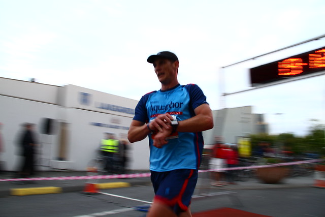
Reykjavik's Midnight Run - 5K race

I am in Iceland for 2 weeks as a grant winner with my proposal to study the geological features of Iceland.  Knowing that I would be in Iceland, I did what almost any avid racer does - look for a race.  I found one in the Midnight Run (run just before midnight) in downtown Reykjavik.  This large 3K, 5K, 10K combo race (1500 participated in one of these three races) is one of the summer solstice week's celebrations.  There is no darkness during this time of year - think summer evenings around 7PM for most locations and you get the idea of what the middle of the "night" looks like around here.  I can still see the sun at midnight a number of thumb lengths above the horizon. 

I ran the 5K since I was arriving in Reykjavik that morning via a red-eye flight out of Boston and figured that I could at least fake a 5K on no sleep and a full day of sightseeing.  I ended up running 19:11 for the 5K placing 10th overall and an impressive 3rd in my age group of 19-39 year olds (I'm age 35) and 3rd American out of 637 runners for the 5K.  Ironically the 1st overall was an American from NC on his way back to the states from a 10 day bike riding trip in Italy.  It was a fantastic experience to see how another country does a race from the course marking to the pre-race dance warm-up (think Zumba) to finishers medals to hosting it at a local swimming pool and hundreds of us going into the hot tub and pools afterward to relax.
  
Finishing the 5K officially in 19:11

Then it was back to "work" with my geology study in Thingvellir with a scuba dive on the plate boundary between the North American & Eurasian plates in 4 degreeC water, visit to the original "geyser" (Iceland is where the word supposedly originated from and from this area of geysers) and I squeezed in a 30 min run around the fjord town of Borgarnes at 10PM (with plenty of light).  More on these activities in another blog post - time for bed!